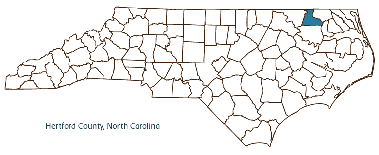
HERTFORD COUNTY GOVERNMENT:
https://www.hertfordcountync.gov/
COUNTY SEAT: Winton
FORMED: 1759
FORMED FROM: Chowan, Bertie, Northampton
LAND AREA: 353.06 square miles
2020 POPULATION ESTIMATE: 21,552
White: 35.5%
Black/African American: 61.0%
American Indian: 1.3%
Asian: 0.8%
Pacific Islander: 0.1%
Two or more races: 1.4%
Hispanic/Latino: 4.1% (of any race)
From State & County QuickFacts, US Census Bureau, 2020.
CONGRESSIONAL DISTRICT: 1ST
BIOGRAPHIES FOR![]()
Hertford County
 WILDLIFE PROFILES FOR
Coastal Plain
GEOGRAPHIC INFORMATION
REGION: Coastal Plain
RIVER BASIN: Chowan, Map
NEIGHBORING COUNTIES: Bertie, Chowan, Gates, Northampton

Hertford County, located in North Carolina's Coastal Plain region and partially bordering the state of Virginia, was formed from Bertie, Chowan, and Northampton Counties in 1759. The county took its name from Francis Seymour Conway, earl and later marquis of Hertford. Communities in the county include the county seat of Winton (originally Wynntown [incorporated in 1766], which replaced Cotton's Ferry), Ahoskie, Murfreesboro, Harrellsville, Como, and Cofield.
Once inhabited by Chowanoac, Meherrin, and Tuscarora Indian tribes, the eastern area of Hertford County was explored by English settlers of the early Roanoke Island and Jamestown colonies and became a British possession known as the Parish of St. Barnabas. Settlers took full advantage of the area's rich farmland as well as the opportunities for fishing offered by the Chowan River. The town of Winton was the first North Carolina town to be burned during the Civil War (20 Feb. 1862).
Though the county later experienced some industrial development and had incorporated manufacturing into its economy by the 1950s, agriculture continued to dominate through the early 2000s, with staples such as tobacco, cotton, peanuts, corn, and soybeans among the leading crops. Chowan College, a Baptist school, was founded in Murfreesboro in 1848. The county also hosts the modern-day Meherrin Indian tribe, which has about 700 members. The overall population of Hertford County was estimated to be 23,700 in 2004.
Annotated history of Hertford County's formation:
For an annotated history of the county's formation, with the laws affecting the county, boundary lines and changes, and other origin information, visit these references in The Formation of the North Carolina Counties (Corbitt, 2000), available online at North Carolina Digital Collections (note, there may be additional items of interest for the county not listed here):
County formation history: https://digital.ncdcr.gov/Documents/Detail/the-formation-of-the-north-ca...
Index entry for the county: https://digital.ncdcr.gov/Documents/Detail/the-formation-of-the-north-ca...
Additional resources:
Corbitt, David Leroy. 2000. The formation of the North Carolina counties, 1663-1943. https://digital.ncdcr.gov/Documents/Detail/the-formation-of-the-north-carolina-counties-1663-1943/3692099?item=4553233 (accessed June 20, 2017).
Hertford County Government: https://www.hertfordcountync.gov/
DigitalNC, Hertford County: https://www.digitalnc.org/counties/hertford-county/
North Carolina Digital Collections (explore by place, time period, format): https://digital.ncdcr.gov
Image credits:
Rudersdorf, Amy. 2010. "NC County Maps." Government & Heritage Library, State Library of North Carolina.
1 January 2006 | Vocci, Robert Blair
